1.Have you ever followed a map and reached your destination… but don’t remember the way? I want to explore a mobile navigation app that focuses not only on speed, but on experience. We move fast, we arrive quickly — but we don’t really experience the city anymore.
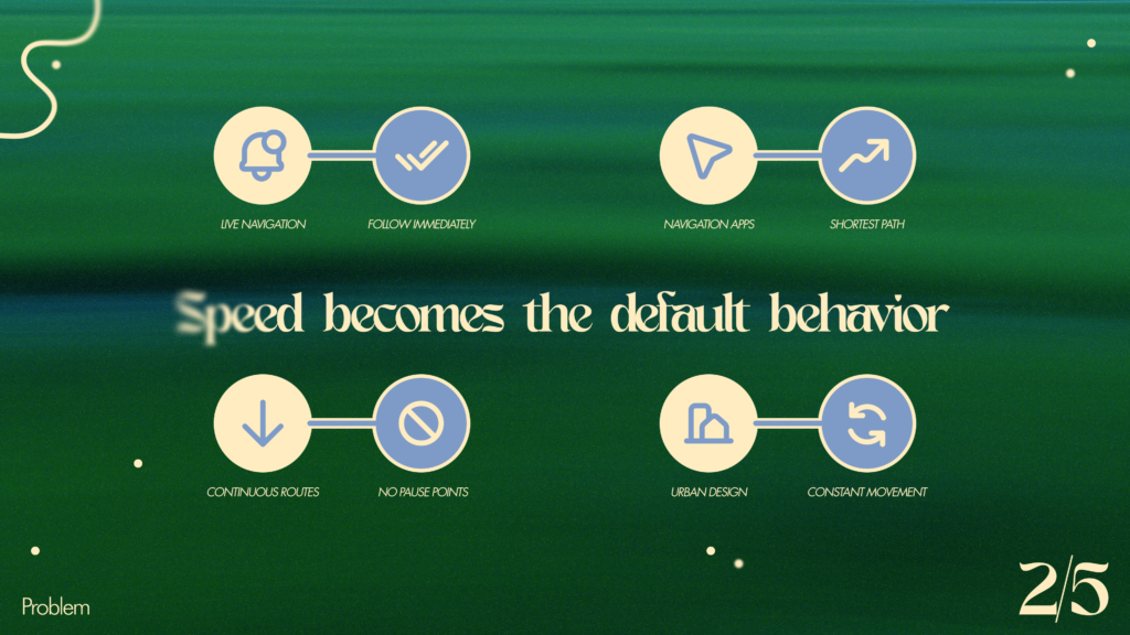
2.Today, navigation is designed for speed. We follow instructions immediately, choose the shortest path, and rarely stop. Cities and interfaces both push us into constant movement — leaving little space to pause, notice, or reflect.
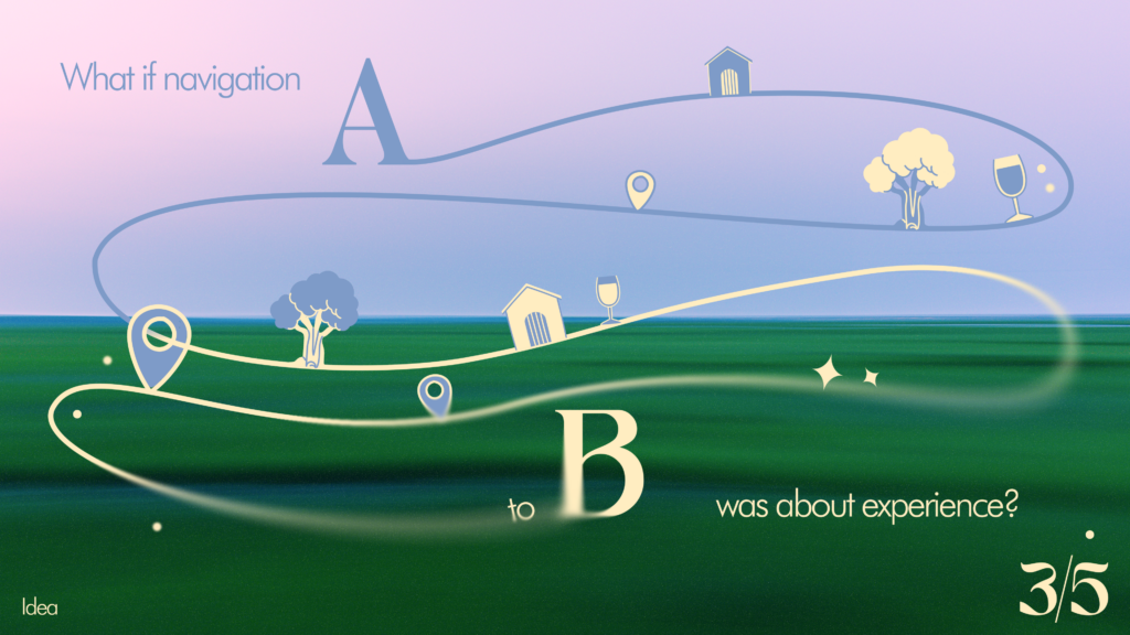
3.What if navigation was not only about getting from A to B, but about experience? I’m exploring a map system that suggests routes based on mood, time, and curiosity — encouraging slower, more intentional movement through the city.
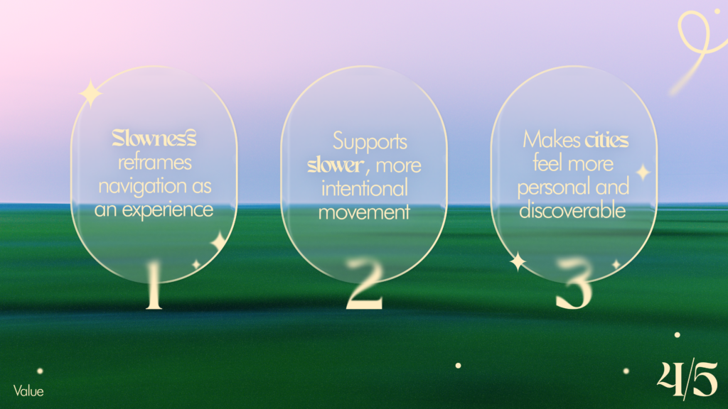
4.This approach reframes navigation as an experience, not just a tool. It supports slower, more mindful movement and helps people build a deeper, more personal connection with the city.
5.My curiosity grows from urban studies, movement, maps, and outdoor exploration. I’m interested in how we experience cities — and how design can gently shift the way we move through them.
Continuing my research on the topic of “Slowness”from last semester, I will be doing further work on this topic as part of the Design & Research II course with Birgit Bachler PhD.
For the final assignment, I will need to record a 2-minute video of the final prototype — in my case, I plan to use prototyping in Figma, which each of you will be able to test. The research will again focus more on contextual analysis, as well as user testing, bibliography, and heuristic evaluation.
In this first blog post, I want to show you three quick lo-fi prototypes for a future app. The task was to create 3 scenarios, and I’ll be presenting each of them today. All of them were put together and thought through quickly, in no more than 20–30 minutes.
*Also, during the second session with Birgit, we did a speed dating exercise, and at the end I’ll go over some notes and discuss the issues my classmates encountered.
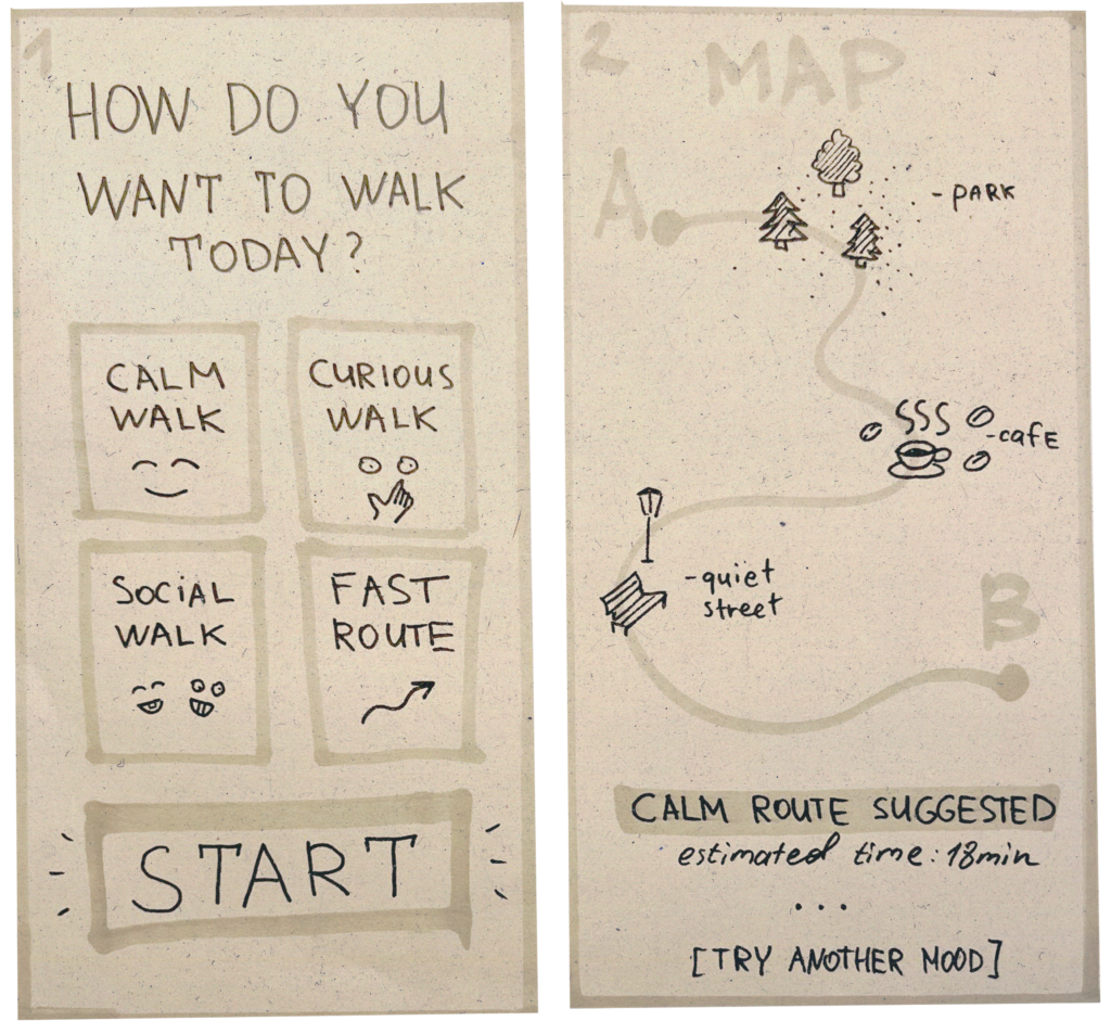
Prototype 1: Mood-based navigation 😁
In this scenario, the user first selects their mood or intention (calm, curious, social, fast), and then receives a route that matches that mood. The route includes different types of spaces — parks, cafes, quiet street, depending on the user’s chosen mood. The goal is to demonstrate how navigation can adapt to the person, rather than just to the geographical task.
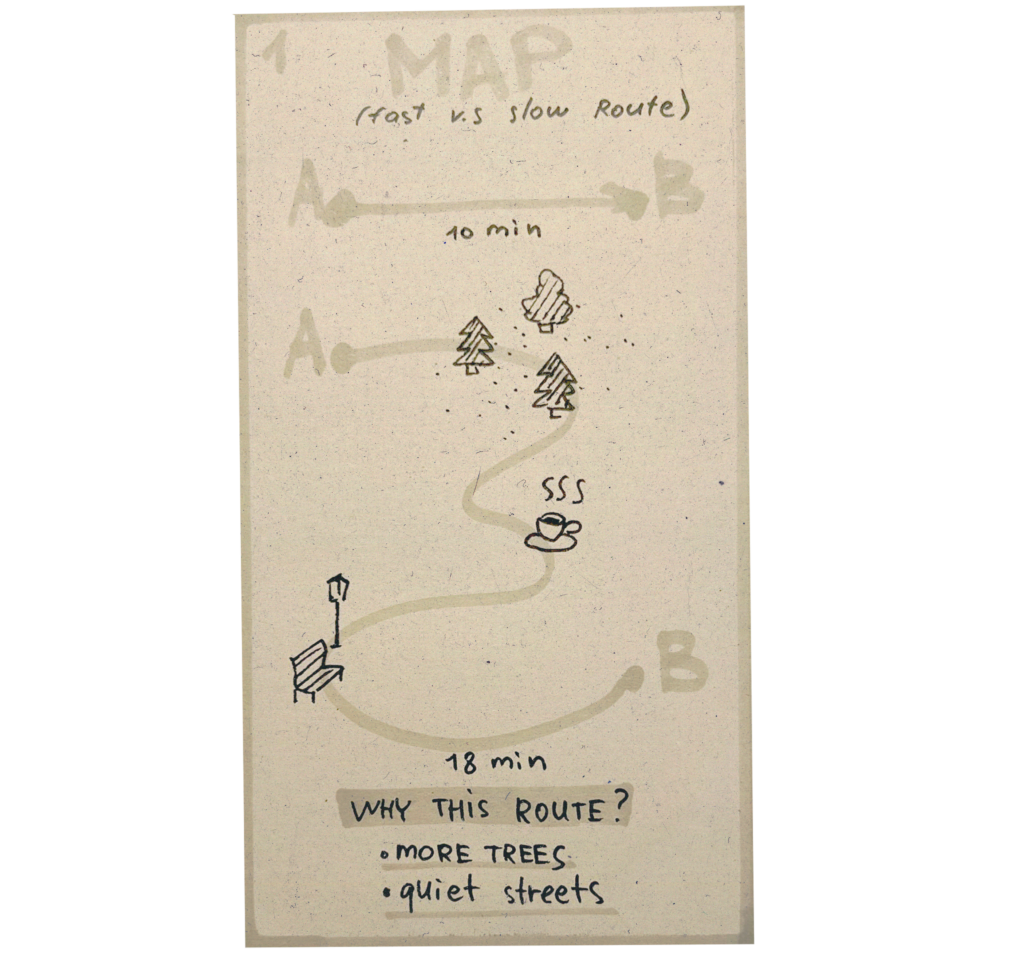
Prototype 2: Fast vs. Slow Route 🏃♀️
This scenario compares two approaches to navigation: “fast” and “slow”. It shows the user that a longer route can be a better experience—it passes through green spaces, quiet streets, and places to stop (such as cafes or shops). The goal is to shift the focus from efficiency to the experience of the route and a conscious choice.
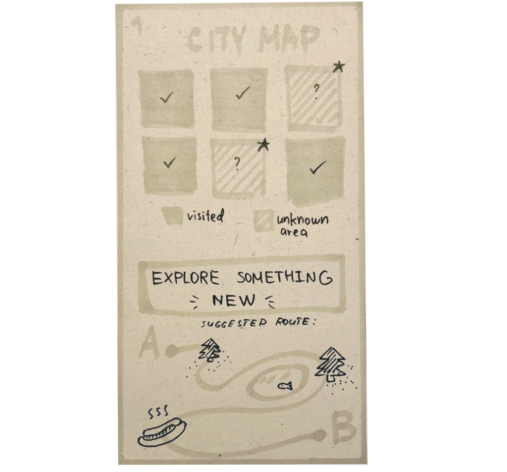
Prototype 3: Explore unknown areas 🤷♀️
Here, the navigation system encourages users to explore unfamiliar parts of the city. The map is divided into “known” and “unknown” zones, and users can choose a route that takes them through new places. The goal is to encourage exploration, step outside of familiar routes, and foster a personal connection with the city.
🗨️ Speed Dating notes:
During testing, additional scenarios emerged that are not covered by the current logic:
First, a safe route is important, especially at night — taking into account street lighting, the presence of people, and the overall sense of safety.
Second, the issue of data collection arose: to implement such routes, we need to understand where to source information, for example, regarding lighting, traffic, locations, and user behavior.
There was also a request for budget-friendly routes, paths that take cost into account (like avoiding expensive locations or suggesting affordable spots), which adds another layer of personalization.
Most navigation systems are designed solely for speed and efficiency. They guide people from point A to point B as quickly as possible, but ignore their mood, context, and the quality of the journey. This creates a sense of passivity, stress, and detachment from the city itself, especially when it comes to large cities or complex journeys.
✍️ Why should we care about it?
Because the way we move around cities affects our attention, stress levels, and attitude toward urban spaces. When navigation focuses solely on speed, people miss out on the city’s opportunities and the chance to explore it. In large cities, this often means we stick to our usual routines and never get to know the city beyond what is strictly necessary.
✍️ What is the solution you are offering? How does it work?
The solution is an adaptive map navigation system that suggests routes based not only on the destination but also on the user’s mood, time of day, and preferences—in other words, on the right kind of onboarding. Instead of always suggesting the fastest route, it can offer alternatives such as peaceful, curious, social, or exploratory paths—for example, through parks, cafes, quiet streets, or unfamiliar neighborhoods. Safety and lighting can also be taken into account.
✍️ Who is the target audience? Who is the customer?
The target audience includes city residents, travelers, immigrants!, researchers, and people seeking more meaningful ways to navigate urban spaces. This is particularly relevant for users who are tired of navigation focused solely on efficiency (such as myself). Clients may include individual users as well as city tourism organizations, municipalities, or mobility-related services interested in promoting a more measured and people-centered urban experience.
✍️ What is going to happen? (Change & Impact)
My product prioritizes mindful navigation over mere ease of use. Instead of simply speeding up movement, users get more information, more choices, and a deeper connection to the city. This can reduce stress, encourage exploration, and help people discover new neighborhoods, rhythms, and everyday experiences in places they already know—or think they know.
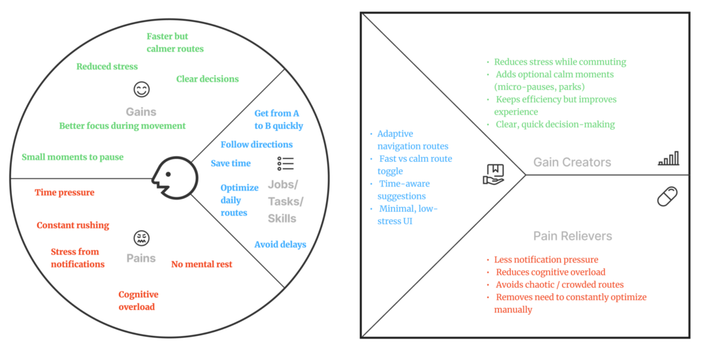
This is a time-conscious person who needs to move efficiently between locations, often under stressful conditions. They rely on navigation to save time, but in doing so experience stress, overload, and reduced alertness. They need routes that remain efficient, reduce mental strain, and allow for brief moments of calm.
🗺️ Persona II – Curious Explorer
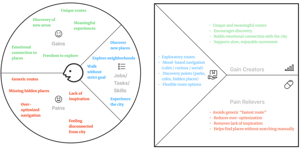
A user who explores the city with an open mind and curiosity, rather than in a hurry. They are interested in discovering new places, atmospheres, and experiences. They need a navigation system that supports exploration, suggests meaningful routes, and helps them engage more deeply with the city.
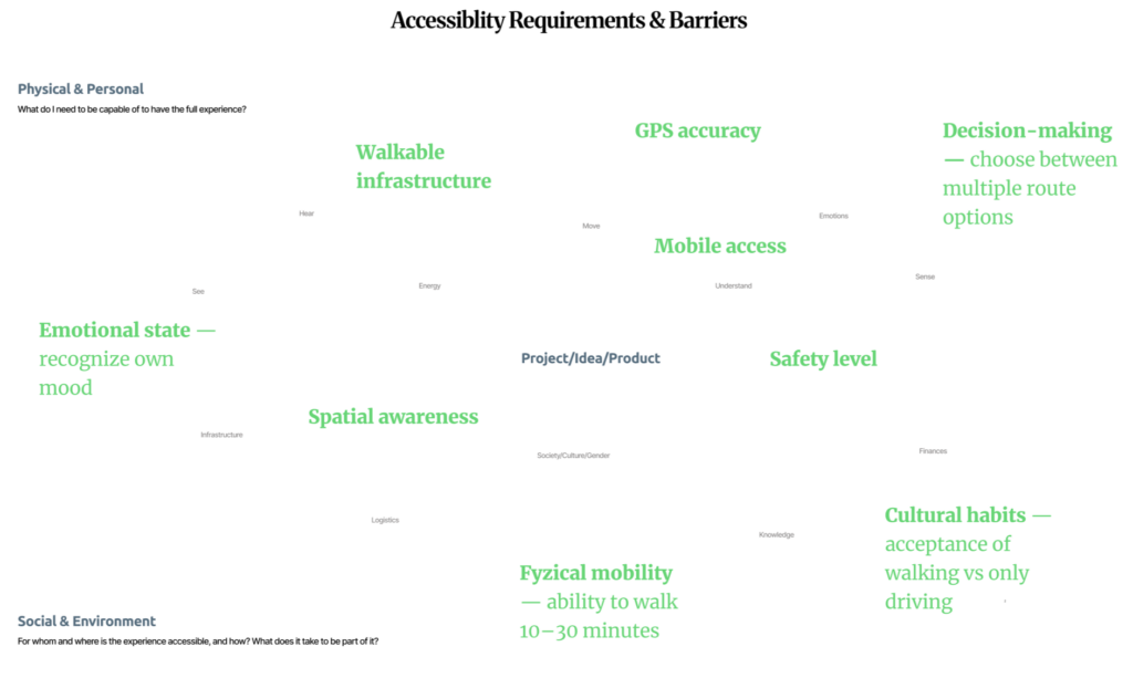
These factors highlight that access to slow navigation is not the same for everyone. The experience depends on physical abilities, emotional awareness, and cognitive skills—such as the ability to walk, recognize one’s mood, and make decisions about the route. It also requires a certain level of spatial awareness, which is not always equally developed or maintained.
At the same time, accessibility is shaped by external conditions: pedestrian infrastructure, GPS accuracy, access to mobile devices, safety, and cultural habits of movement. This shows that slow navigation is not just a matter of design, but a systemic issue influenced by the environment, technology, and the social context in which the user finds themselves.
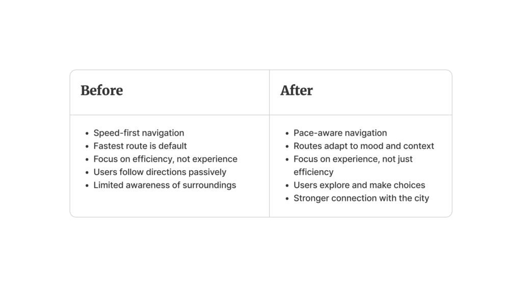
This comparison highlights the shift from efficiency-oriented navigation to experience-oriented movement. Most existing navigation systems prioritize speed, offering the fastest route by default and guiding users through the city with minimal user involvement.
As a result, users typically follow directions passively, often losing their sense of the surrounding environment and missing opportunities to interact with it. Travel becomes functional rather than experience-driven.
In contrast, this project explores navigation as something more adaptive and human-centered—where routes respond to mood and context, encourage exploration, and foster a more meaningful relationship with the city.
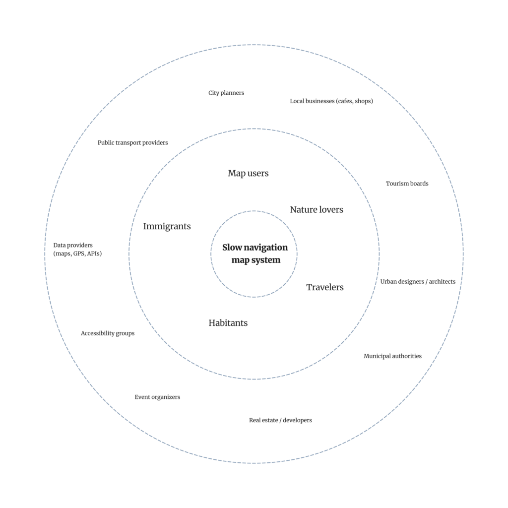
This diagram illustrates the broader ecosystem surrounding my slow map navigation system. At the center are the direct users—people who move around the city with different needs, rhythms, and intentions. Surrounding them are groups that use maps in their daily lives, from residents to travelers, each of whom perceives the city in their own way.
The outer layer shows indirect users—entities that do not use the product itself but shape the conditions in which it exists. Urban planners, local businesses, infrastructure, and data systems—all of these influence how we move, which routes are available, and how the city is perceived.
Together, this underscores that navigation is not just a tool, but part of a larger system. How we move through the city is shaped not only by personal choice, but also by design decisions, the environment, and the social structures around us.
Most modern navigation tools are optimized for one goal: efficiency. The fastest route. The shortest time. The fewest obstacles.
But cities are not just systems for getting around. They are places to experience, observe, and gradually build relationships with. And our movement through them shapes our sense of connection — or alienation.
I imagine a different type of navigation. One that adapts not only to geography, but also to people.
What if a map asked not only where you want to go, but also how you want to feel along the way?
🗺️ A map that takes into account:
⭐ your mood (calm, curious, tired, sociable); ⭐ your time (a quick walk or a day off); ⭐ your preferences (parks, cafes, quiet streets, shops, dog-friendly routes etc.); ⭐ and your familiarity with the city.
💡 Instead of constantly directing you along the same optimized routes, the system could gently suggest alternatives:
👉 a longer route through the park when you need to slow down; 👉 a street you’ve never walked down before; 👉 a neighborhood you usually pass by, but never visit; 👉 a café along the way when the time seems right.
This wouldn’t remove choice — it would expand it. Multiple routes. Different rhythms. Clear intentions.
*Video is AI generated
Research by Gregory D Clemenson already shows that the way we navigate affects how we remember places and how focused we are on what is happening. Clear step-by-step instructions can reduce spatial awareness and personal engagement with the environment, while more exploratory or sensory forms of navigation promote cognitive mapping and concentration. [2]
Urban theorists such as Jan Gehl have long argued that cities should be designed with human experience in mind—for walking, stopping, observing, and staying—rather than solely for high throughput and speed. However, digital navigation often pulls us in the opposite direction. [3]
In large cities such as Vienna, London, New York, or Moscow, it is easy to live in a very small personal world:
🏠 home → 🖥️work → ☕favorite café → 🛍️supermarket
Entire neighborhoods remain unknown, even after many years of living there. A slow, adaptive navigation system could gently open up these worlds. Not by forcing detours, but by inviting them.
I want to explore this idea in more detail: to develop a navigation interface that prioritizes quality of movement over speed, awareness over automation, and choice over control.
A map that doesn’t rush you to your destination, but helps you build a relationship with the city along the way.
💚Thank you!💚
Sources 🛈
[1] Mobile photo: Movement. 35AWARDS Photography Contest. Best of Contest, Viewer’s Choice, Top 35. Photographer: Margo Aleksandrovna Vorobeva. Available at: https://35awards.com/page/contests/num/743
Most navigation tools are built around one promise: get me there fast. The “best” route is usually the shortest, fastest, or most efficient. And, as with many digital products, this default value subtly trains us to behave in a certain way: we start moving through places rather than being in them.
This article looks at maps as interfaces that design movement. Not just in apps, but in cities too. When a system optimizes speed, it changes what we pay attention to, how we feel while traveling, and what we remember afterward.
🤔 Why this matters (beyond convenience)
❗ Your attention narrows: you follow instructions rather than your surroundings. ❗ Exploration slows down: you stop noticing landmarks, textures, narrow streets, and “micro-attractions.” ❗ Stress builds up: constant updates and the “keep moving” logic can feel like pressure—similar to how notifications increase the sense of urgency in digital life.
🚶➡️ Maps as “pace setters”
When using turn-by-turn navigation, you delegate some of the tasks of orientation and decision-making. Research in the field of navigational assistance has raised concerns that clear directions may reduce the effectiveness of spatial learning (you reach your destination, but remember less information about the route).
This is the key question of “slow living” in navigation:
Do we need a tool that simply takes us from point A to point B, or one that helps us connect with the place?
“…current GPS apps (based on turn-by-turn navigation) promote a passive form of navigation that does not support learning or the formation of cognitive maps.” — Microsoft Research, Redmond (2021) [1]
🗺️ Comparing map logics (what each app “optimizes for”)
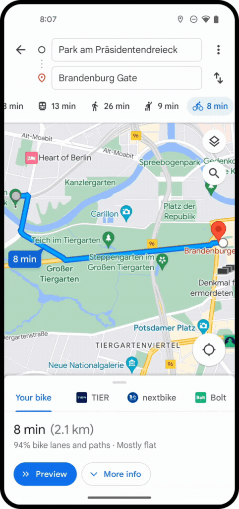
1. Google Maps[2]
👉 Key principle: efficiency + accessibility for all
Advantages: ➕Extremely efficient A→B routing, multimodal options, reliable POI database.
Designed for quick decision-making: “best route,” “fastest route,” “leave now.”
Disadvantages: ➖The “fastest” approach may dominate, even if you have time. ➖Research is present, but it is secondary to speed (you can explore, but the interface pushes you toward achieving your goal).
Advantages: ➕ Often very detailed dense urban development: entrances, public transport logic, accurate location determination. ➕ The feeling of “the city as a system”: created for everyday travel in difficult conditions.
Disadvantages: ➖ As a rule, it supports a functional rhythm focused on daily travel: fast, straightforward, problem-solving.
Advantages: ➕ Great for hiking as an activity, not just a means of transportation. ➕ Offline-oriented logic and detailed route information encourage exploration and the creation of longer routes.
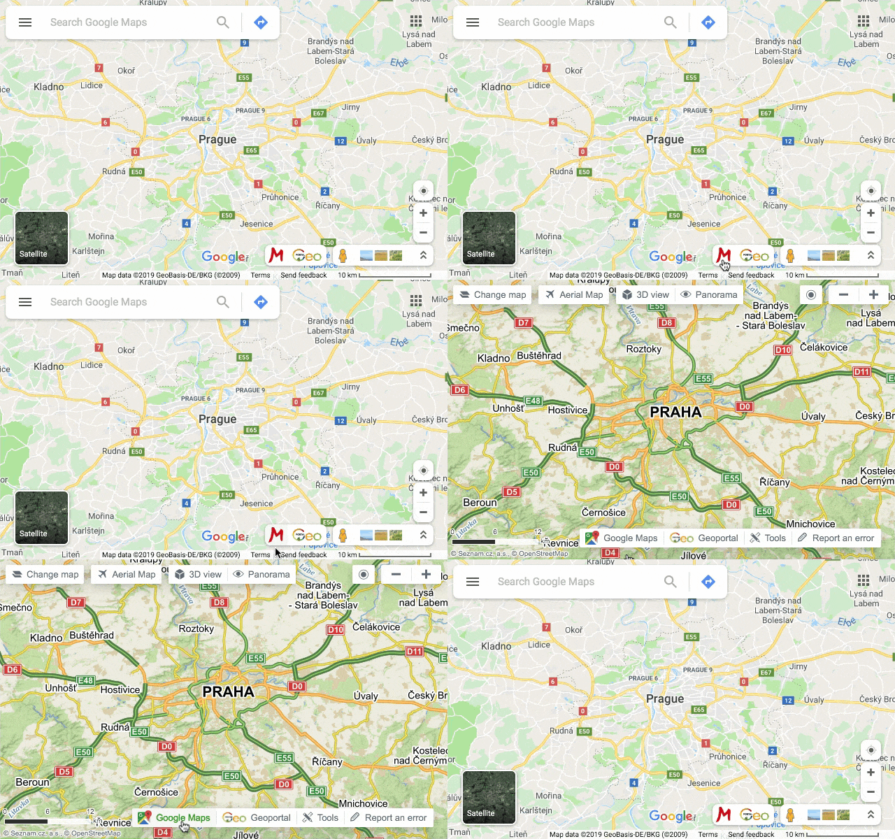
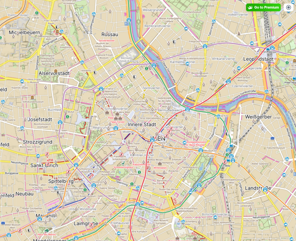
Specific example:Mapy.cz emphasizes offline maps and convenient route planning as a key set of features (especially useful for hiking, trekking, and traveling).
Disadvantages: ➖ The product “expects” you to wander. This expectation alone changes the pace.
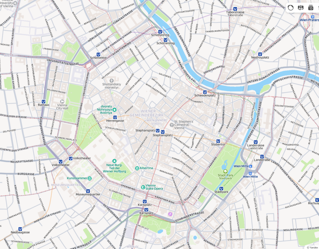
Let’s compare the same place — the city center of Vienna — across different map interfaces:
Google maps
Yandex maps
Mapy.cz
🙋 Why would “slow navigation” be optimized?
If we rewrite the criteria for success, we get a different interface:
Instead of: the fastest route Try: a peaceful route / an interesting route / a safe route / an accessible route / a shaded route / a scenic route
Slow navigation could purposefully include: 👉 landmarks (parks, observation decks, cafes) as key elements of the route 👉 rest stops (benches, quiet places, small squares) as part of the journey 👉 a gentle choice instead of one “best” route (3 moods, not 3 minutes)
This is directly related to the city: if streets are shared spaces, design should not only serve drivers and speed.