Continuing my research on the topic of “Slowness”from last semester, I will be doing further work on this topic as part of the Design & Research II course with Birgit Bachler PhD.
For the final assignment, I will need to record a 2-minute video of the final prototype — in my case, I plan to use prototyping in Figma, which each of you will be able to test. The research will again focus more on contextual analysis, as well as user testing, bibliography, and heuristic evaluation.
Social geography and who the city is for 🤼🏻
The next important question for my project is: who is “slow navigation” actually designed for? At first glance, it might seem that “slow routes” are suitable for everyone: tourists, locals, people who love to walk, or those who want to explore the city. But if we look deeper, the city isn’t the same for everyone. Different people move through it in different ways, and this falls under the umbrella of social geography.
Social geography helps us think of the city not only as a physical space but also as a social experience. The same route can be pleasant for one person and inconvenient or even unsafe for another. For example, a tourist might be looking for beautiful streets and cafes, a local resident might be looking for a peaceful route after work, someone walking a dog might be looking for green spaces, and a person with limited mobility might be looking for a flat route without steep inclines or stairs.
Social geography is a subfield of human geography that examines the relationship between society and space. While there is no universally accepted definition, it is generally understood as the study of societal dynamics from a spatial perspective, exploring how people interact with their environment across time and place. This area of study encompasses various topics, including the differences between locations and their residents, the transformations of places, and the ways individuals perceive and alter landscapes. [1]
The PDF [2] includes an important note that Situationism and similar theories often stemmed from a Western, male, and academic tradition and may not have taken into account the experiences of women, queer people, colonized populations, and people of color. It also states that it is important to consider structural barriers and the fact that not everyone can “wander” through the city with the same degree of freedom.
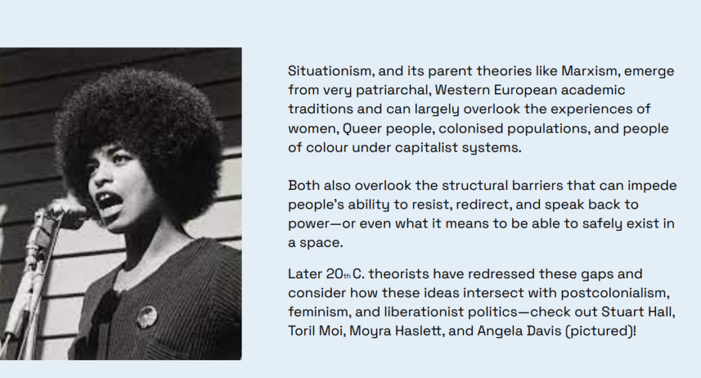
This is a very important point for my app. If I use the ideas of dérive and free exploration of the city, I can’t simply say, “Let people go wherever they want.” For some, this truly represents freedom, while for others, it means stress, risk, or physical limitations. Therefore, slow navigation must take into account not only mood and interests, but also safety, accessibility, physical exertion, lighting, proximity to public transportation, and the user’s personal boundaries.
Here, I also find the idea from data feminism useful. Authors Catherine D’Ignazio and Lauren Klein [3] suggest thinking about data through the lens of power, context, and inequality. For my project, this means that a map shouldn’t pretend to be neutral. If an app shows the “best route,” we need to ask: best for whom? For a young tourist? For an older person? For someone with anxiety? For someone who doesn’t speak the language? For a young woman walking alone at night?
That’s why, in the future prototype, I want to focus more on modes and settings – not just “fast/slow,” but more specifically: quiet, safe, green, accessible, dog-friendly, low-stairs, familiar, and exploratory. This makes the app not just a pretty alternative to Google Maps[4], but a more human-centered system that acknowledges the different ways of experiencing the city.
For me, the main takeaway from this phase is this: slow navigation shouldn’t romanticize walking. It should take into account that a city can be inspiring, but also challenging, noisy, inaccessible, or unsafe. If the app wants to create higher-quality routes, it must consider not only the beauty of the path but also the user’s social context.
Sources 🛈
[1] EBSCO Research Starters. Social Geography. EBSCO Information Services. Available at: https://www.ebsco.com/research-starters/geography-and-cartography/social-geography
[2] Bachler, B. Intro to Information Design – Session 5: Commuting Cartographies. FH JOANNEUM, 2025.
[3] D’Ignazio, C., & Klein, L. Data Feminism. MIT Press, 2020. Available at: https://data-feminism.mitpress.mit.edu
[4] Google Maps. Google LLC. Available at: https://www.google.com/maps
